

Surveying Services
Hydrographic Surveying


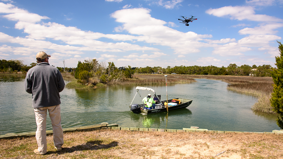
GEL Engineering provides the solid data you need to support dredging, waterfront, and water dependent engineering projects.
Good data is the basis of successful projects—you need accurate data in a timely manner to start your project and keep it moving forward. GEL Engineering offers a full range of hydrographic surveying services to governmental agencies, public institutions and private companies. We have provided hydrographic surveys to support dredging projects, waterfront development, dock installations, water dependent engineering, environmental remediation and more.
We provide the following services:
- Condition surveys
- LIDAR
- Single and dual frequency surveys
- Side Scan Sonar surveys
- Pre and post-dredge surveys
- Beach profiles and renourishment
- USACE Class 1 dredge payment surveys
- Safety of navigation surveys
- Levee and embankment surveys (land and marine)
The GEL Engineering Difference
- Data you can trust. Accuracy is key and we have built our business on delivering just that: consistently trustworthy data that gives you peace of mind and the confidence to safely move your project forward.
- Proper tools and technology. At GEL Engineering, we use our own equipment to survey, chart and model for our clients, including LIDAR, bathymetric technology and side-scan sonar. Our mapping systems include AutoCAD, Terramodel, TRITON, CARIS and ARC/INFO, and GPS technology. We use our hydrographic surveying vessels, Trimble DGPS and RTK GPS, Odom CVM Echotrac dual-frequency depth sounder, and Hypack MAX Software to perform pre and post dredge hydrographic surveys for industrial facilities and marinas. GEL Engineering can compute both allowable and removed volumes from the data obtained during the survey. We plot the results in drawings using appropriate local datums.
- Professionals that go the extra mile. Our highly skilled hydrographic surveyors include Professional Land Surveyors and Hypack Certified Hydrographers with experience that ranges from inland waters and rivers to ports and near-shore environments. They are used to working safely in difficult conditions and have built a reputation for collecting accurate data under all conditions.
Contact us to learn more about our hydrographic surveying services.